Nissan Titan A60. Manual - part 93
AV
NAVIGATION SYSTEM
AV-197
< SYSTEM DESCRIPTION >
[PREMIUM WITH NAVIGATION]
C
D
E
F
G
H
I
J
K
L
M
B
A
O
P
NAVIGATION SYSTEM
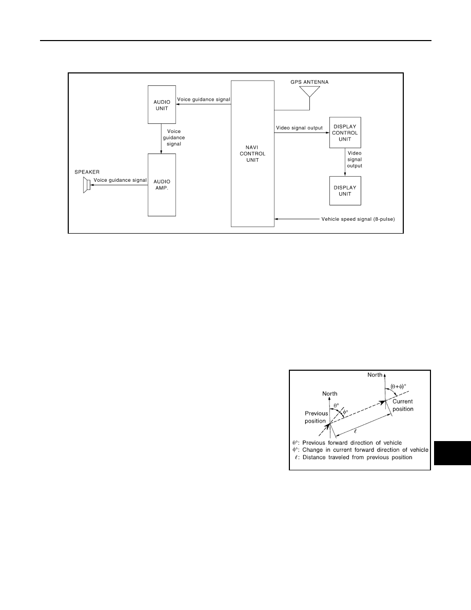
System Diagram
INFOID:0000000006166557
System Description
INFOID:0000000006166558
NOTE:
Refer to NAVI System Owner's Manual for system operation.
The navigation system periodically calculates the vehicle's current position according to the following three
signals: Travel distance of the vehicle as determined by the vehicle speed sensor, turning angle of the vehicle
as determined by the gyroscope (angular velocity sensor), and the direction of vehicle travel as determined by
the GPS antenna (GPS information).
The current position of the vehicle is then identified by comparing the calculated vehicle position with map data
read from the map DVD-ROM, which is stored in the DVD-ROM drive (map-matching), and indicated on the
screen with a current-location mark.
By comparing the vehicle position detection results found by the
GPS and by map-matching, more accurate vehicle position data can
be used.
The current vehicle position will be calculated by detecting the dis-
tance the vehicle moved from the previous calculation point and its
direction.
TRAVEL DISTANCE
Travel distance calculations are based on the vehicle speed input signal. Therefore, the calculation may
become incorrect as the tires wear down. To prevent this, an automatic distance fine adjustment function has
been adopted.
TRAVEL DIRECTION
Change in the travel direction of the vehicle is calculated by a gyroscope (angular velocity sensor) and a GPS
antenna (GPS information). As the gyroscope and GPS antenna have both merit and demerit, input signals
from them are prioritized in each situation. However, this order of priority may change in accordance with more
detailed travel conditions so that the travel direction is detected more accurately.
AWNIA1625GB
SEL684V