Infiniti I35 (A33). Manual - part 459


  Index      Infiniti     Infiniti I35 (A33) - service repair manual 2004 year


Search            


Content   ..  457  458  459  460   ..


Infiniti I35 (A33). Manual - part 459


4

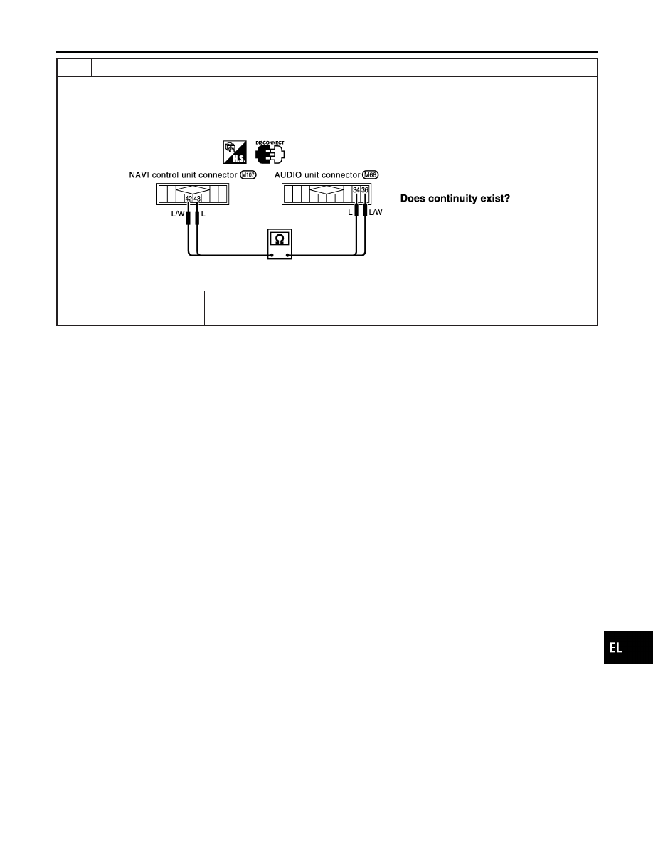
CHECK VOICE SIGNAL CIRCUIT

1. Turn ignition switch OFF.
2. Disconnect NAVI control unit connector and AUDIO unit connector.
3. Check continuity between NAVI control unit terminal 42 and AUDIO unit terminal 36.
4. Check continuity between NAVI control unit terminal 43 and AUDIO unit terminal 34.

SEL833Y

Yes or No

Yes

©

Repair or replace audio unit. Refer to “AUDIO” in EL section of Service Manual.

No

©

Repair or replace harness or connector.

GI

MA

EM

LC

EC

FE

AT

AX

SU

BR

ST

RS

BT

HA

SC

IDX

NAVIGATION SYSTEM

Trouble Diagnoses (Cont’d)

EL-437

This Condition Is Not Abnormal

=NHEL0304

EXAMPLE OF BASIC OPERATIONAL ERRORS

NHEL0304S01

Symptom

Possible cause

Repair order

No image is dis-
played.

Monitor brightness control is set to full dark.

Readjust monitor brightness.

Map does not appear
on display.

Map CD is not inserted or inserted upside down.

Insert the map CD with the label facing up.

Map mode is turned OFF.

Press the “MAP” button.

No guide tone is
heard.

Voice guide adjustment OFF/Volume is set to the
lowest or highest level.

Adjust the voice guide level.

Voice guide volume is
too high or too low.

Dark display/Slow
image movement

Low vehicle interior temperature

Wait until vehicle interior temperature rises to appro-
priate level.

Small black or white
dots appear on the
screen.

Unique liquid crystal display phenomena

No problem

“Unable to read CD”
message appears
only during specified
operation.

Map CD surface is tainted/CD surface is partially
scratched.

Check map CD surface. If dirty, wipe clean with a
soft cloth.

If map CD surface is damaged, replace the CD.

Area place names are not displayed.
If area place names do not appear on the map display, these names may not be available. Use the BIRD-
VIEW

T

flat surface map display function. Display output may differ. Note the items related to BIRDVIEW

T

below.

I

Priority is given to the display of place names in the direction of vehicle travel.

I

Extended display of vehicle travel distance for both surfaces and steering angle (flat directional changes).
This phenomenon disappears after the display image has been replaced by another one.

I

The names of route and area might vary between the immediate front area and distance front area.

I

Alphanumeric display characters are limited to maintain display simplicity and clarity. Display details may
differ with time and place.

I

Identical place and road names may appear on the display at more than one location.

NAVIGATION SYSTEM

This Condition Is Not Abnormal

EL-438

EXAMPLE OF CURRENT VEHICLE POSITION MARKER ERROR

=NHEL0304S02

The navigation system reads the vehicle distance and steering angle data. Because the vehicle is moving,
there will be an error in the current position indication. After the error appears, drive the vehicle for a short
distance. Stop the vehicle. If the position marker does not return to its original position, perform “Adjust Cur-
rent Location” MODE (EL-429).

SEL698V

GI

MA

EM

LC

EC

FE

AT

AX

SU

BR

ST

RS

BT

HA

SC

IDX

NAVIGATION SYSTEM

This Condition Is Not Abnormal (Cont’d)

EL-439

Possible cause

Drive condition

Service procedure

Area

Slippery road surface

On wet, icy, or gravel road where
frequent wheel slippage occurs, dis-
tance calculations may be errone-
ous. The position marker may show
the vehicle to be in inaccurate posi-
tion.

If the position marker does
not move to the correct posi-
tion even after the vehicle
has been driven approxi-
mately 10 km (6 miles), per-
form “Adjust Current Loca-
tion” MODE (EL-429). If
necessary, perform “Speed
Calibration” (EL-422).

Slanted area

Hilly areas where the road has
banked curves. When the vehicle
enters these banked curves, there
may be an error in steering angle
measurement. The position marker
may show the vehicle to be in inac-
curate position.

Map
data

Map display for a given road does not appear.

SEL699V

When the vehicle is driven on a
newly constructed road that does
not appear on the existing map. Map
marking and calibration are not pos-
sible. The position marker may indi-
cate inaccurate position in close
proximity to the actual position.
Subsequently, when the vehicle is
driven on a road which is available
as map data, the position marker
may still indicate an inaccurate posi-
tion.

The vehicle is driven on a road whose course has
been altered (usually to improve the road or to
eliminate some hazard).

SEL700V

When the map data shown on the
display and the actual conditions are
different. Map matching will not be
possible. The position marker may
indicate inaccurate position in close
proximity to the actual position. If the
vehicle is driven on the indicated
road, further errors may occur.

Vehicle Use of tire chains (Stormy weather)

Tire chains will affect distance sens-
ing. The position marker may indi-
cate inaccurate position.

If the position marker does
not move to the correct posi-
tion even after the vehicle
has been driven approxi-
mately 10 km (6 miles), per-
form “Speed Calibration” (EL-
422). 
After removing the tire
chains, sensing accuracy
may recover by itself.

NAVIGATION SYSTEM

This Condition Is Not Abnormal (Cont’d)

EL-440


Content   ..  457  458  459  460   ..